
Probe Vehicle System Concept
Acquisition of road traffic data is an important aspect
of Road traffic Informatic systems.
 An innovative approach is utilizing the vehicles
themselves as a source of real-time traffic data, functioning as roving traffic probes. This
principle was probably first touched upon in the early 1970s in the course of a pilot with the
Japanese Comprehensive Automobile Traffic Control System (CACS), which was a
government
sponsored program aimed at the development of a route guidance and traffic information
system. Besides inductive loops to transmit guidance information to CACS-equipped
vehicles,
also employment of the vehicles themselves to collect traffic data was propounded.
An innovative approach is utilizing the vehicles
themselves as a source of real-time traffic data, functioning as roving traffic probes. This
principle was probably first touched upon in the early 1970s in the course of a pilot with the
Japanese Comprehensive Automobile Traffic Control System (CACS), which was a
government
sponsored program aimed at the development of a route guidance and traffic information
system. Besides inductive loops to transmit guidance information to CACS-equipped
vehicles,
also employment of the vehicles themselves to collect traffic data was propounded.
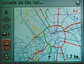
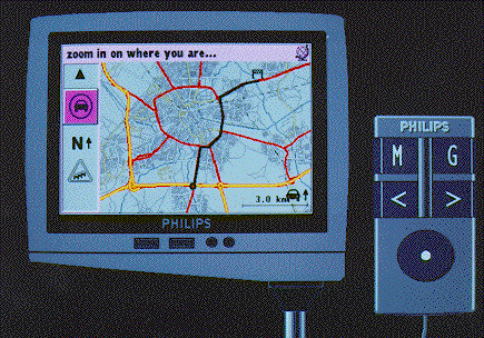
The development of present-day in-vehicle equipment started with
- autonomous
(electronic)
positioning and
navigation devices, to assist drivers
in the process of way finding and providing information
on
the current location and how this relates to the destination, and
- communication systems for gathering and dissemination
of information (e.g. RDS)
A combination of static navigation systems and dynamic traffic information was the next
step,
and resulted in the first types of dynamic navigation or guidance systems.
Probe Vehicles: Floating Car Data
At a sufficiently high percentage of vehicles equipped with a
dynamic route guidance (DRG) device acting as roving traffic detectors, a non-infrastructure
based traffic monitoring system results. Furthermore, not only DRG-vehicles can collect
experienced traffic data as it is certainly conceivable that certain (categories of) vehicles are
specially equipped for performing this task (e.g. vehicles from the freeway service patrol or
roadwatch).
Such vehicles, which are participating in the traffic flow and
capable of determining experienced traffic conditions and transmitting these
to a traffic
center are called
probe vehicles.
To determine its position and to register
experienced traffic conditions, a probe vehicle is equipped with on-board electronics, such as
a
location and a communication device. By means of the location device, the probe vehicle
keeps
track of its own geographic position. By means of the communication device, the probe
vehicle
transmits its traffic experiences via a mobile communication link to a traffic center. In this
traffic center the traffic data received from the probe vehicles is gathered, possibly combined
with data from the other monitoring sources, and processed into relevant traffic information.
In
the traffic center decisions are made as whether to take corrective actions (e.g. ramp
metering),
supply information (e.g. variable message signing) or disseminate information directly to the
car
drivers (e.g. travel advisories, traffic information and dynamic route guidance).
Such ATIS System concept comprises the following
components:
- traffic center,
- probe vehicles, and
- mobile communication network.
Traffic Center
The traffic center includes the physical building, equipment (hardware, internal computer
networks), software and procedures, and persons within this building. In this way, they
constitute the information systems that administer the traffic
processes. According to the ultimate objective of the traffic center we discern a Traffic
Management
Center (TMC) for the ATMS purposes and a Traveler Information Center (TIC) for the
ATIS purposes.
The task of both the TMC and the TIC is to process the received probe messages,
for the TMC the probe data is combined with data from other sources, into relevant
information
about actual and predicted traffic conditions.
Probe Vehicles
In the probe vehicle concept vehicles themselves are acting as roving traffic detectors, which
are
not bound to specific and fixed locations along the road infrastructure.
Several strategies can be adopted for constructing the traffic messages to be transmitted by
the
probe vehicles. For instance, each probe can transmit a traffic messages
once
every time interval containing its location and its speed at the instant of transmission. The
time
interval will be shown to be either more or less fixed or to be exogenously determined.
Determination of the instantaneous location of the probe can take place according to various
techniques.
As travel times between two points are more reliable than
measurements of the speed of vehicles at one particular point along the road, probe vehicles
participating in the road traffic and automatically reporting the (link) time needed for traveling
between two intersections are a precious source of road traffic data. Therefore, the probe
reports should contain travel time information instead of spot speed information.
As the concept of traffic monitoring through probe vehicles has the potential advantage that
also
actual information about traffic flows in urban road networks can finally be obtained, the
location technique to be chosen for the probe vehicle application has to have a high
performance
in urban areas. For this reason one could adopt a hybrid positioning system, combining
differential GPS (DGPS) with map-matching and dead-reckoning. The reliability of this combined location
method is very high and the accuracy is about 2 to 10 meters.
In this way, a serious limitation
remains that, even on freeways, differentiation per lane is impossible
and hence all further
computations for extracting traffic information from probe data are
necessarily restricted to
a conjoined freeway.
Mobile Communication Network
Conscientious transmission of the traffic data experienced by the probe vehicles to the traffic
center (either TMC or TIC) is one of the most crucial aspects of probe vehicle traffic
monitoring, because probe vehicle data will play a significant role in advanced traffic
systems
and communication characteristics may considerably affect the quality of this data source.
Several options exist to send data from the probes to the infrastructure
- Random-Access Transmissions. The format for transmission can be of ALOHA
type,
but retransmission of lost messages may not be necessary.
- Vehicle Polling.
Example
For the San Francisco Bay Area we worked out the performance of a probe vehicle system.
The performance of ALOHA access is compared with polling with cellular frequency reuse.


 An innovative approach is utilizing the vehicles
themselves as a source of real-time traffic data, functioning as roving traffic probes. This
principle was probably first touched upon in the early 1970s in the course of a pilot with the
Japanese Comprehensive Automobile Traffic Control System (CACS), which was a
government
sponsored program aimed at the development of a route guidance and traffic information
system. Besides inductive loops to transmit guidance information to CACS-equipped
vehicles,
also employment of the vehicles themselves to collect traffic data was propounded.
An innovative approach is utilizing the vehicles
themselves as a source of real-time traffic data, functioning as roving traffic probes. This
principle was probably first touched upon in the early 1970s in the course of a pilot with the
Japanese Comprehensive Automobile Traffic Control System (CACS), which was a
government
sponsored program aimed at the development of a route guidance and traffic information
system. Besides inductive loops to transmit guidance information to CACS-equipped
vehicles,
also employment of the vehicles themselves to collect traffic data was propounded.